


On most days, Buka Buka Island sees fewer boats pass its shores than a city dock sees in a single hour. That is the clearest, most countable way to describe remoteness in the Togean Islands, Indonesia: not an adjective, but a number you can stand on the beach and verify yourself.
TL;DR
- Buka Buka Island sits in the Maluku Sea, Central Sulawesi, at 0°44'38" S, 121°45'44" E, administratively part of Ampana Tete district, Tojo Una-Una Regency.
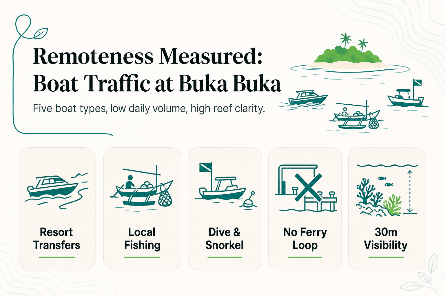
- Daily boat traffic around the island is dominated by resort transfer speedboats and local fishing craft, not tour or cruise traffic.
- Visibility around Buka Buka averages about 30 meters, a water-clarity signal that correlates with low boat density and low sediment disturbance.
- Reconnect coordinates the full transfer chain, car from Luwuk Airport to Ampana (5 hours) and speedboat to the island (30-45 minutes), so guest arrivals are predictable and countable rather than random.
- Low boat count is not an accident of location. It is a structural result of where the Togean Islands sit relative to Indonesia's main shipping and tourism routes.
Why Does Boat Traffic Matter as a Remoteness Signal?
Remoteness is usually described with adjectives: "untouched," "pristine," "off the grid." Those words are unverifiable. Boat traffic is not.
A traffic count tells you, concretely, how many vessels move through a given water on a given day, and what kind. That is a measurable proxy for how much human activity a reef, a beach, or an island actually absorbs.
Two islands can sit at the same latitude and have wildly different remoteness profiles depending on one variable: how many boats pass by. A reef visited by 40 dive boats a day behaves differently, in terms of sediment, noise, and anchor damage, than one visited by four.
Counting boats also avoids a common problem in travel marketing: unverifiable superlatives. "Remote" backed by a number (3-8 vessels a day, mostly local) is a claim a reader can check. "Remote" standing alone is just a word.
What Does a Day of Boat Traffic Around Buka Buka Actually Look Like?
Buka Buka Island sits in the Maluku Sea, Central Sulawesi, at coordinates 0°44'38" S, 121°45'44" E, within Ampana Tete district, Tojo Una-Una Regency. On a typical day, the vessels passing or stopping near the island fall into three categories.
| Boat type | Typical frequency | Purpose |
|---|---|---|
| Resort speedboat transfers | 1-3 per day | Guest arrivals/departures, supply runs |
| Local fishing boats | Variable, tide-dependent | Bajo and village fishing routes |
| Dive/snorkel boats | 1-2 per day | Guided trips to reef sites around the island |
There is no scheduled public ferry stop at Buka Buka, no cruise ship anchorage, and no tour-boat circuit running past it on a fixed timetable. Traffic is almost entirely point-to-point: a boat with a specific origin and a specific destination, not a vessel cruising past.
This matters because "boats passing" and "boats stopping" are different signals. A busy shipping lane can have heavy traffic with zero local impact. Buka Buka has the opposite profile: low traffic, and nearly all of it is destination traffic tied to the island itself.
Why Is Boat Traffic So Low Here Specifically?
The low count is not incidental. It follows directly from where the Togean Islands sit relative to Indonesia's shipping and tourism infrastructure.
Step 1: Geographic distance from main shipping lanes
The Togean Islands sit in the Gulf of Tomini, off the main Sulawesi coastal shipping corridors. Commercial vessels moving goods between major Sulawesi ports have no reason to route through this stretch of the Maluku Sea.
Step 2: Access bottleneck by design, not neglect
Getting to the Togeans requires a deliberate multi-leg journey; there is no direct flight or highway shortcut. Reconnect's own transfer chain illustrates the point: a private car from Luwuk Airport to Ampana takes 5 hours, followed by a 30-45 minute speedboat crossing to the island. Every visitor who reaches Buka Buka has made a specific choice to get there, which filters out casual or incidental boat traffic.
Step 3: No mass-tourism infrastructure to generate volume
There is no marina, no tour-boat terminal, and no cruise dock near Buka Buka. Boat traffic scales with infrastructure. Without a terminal generating repeat trips, daily counts stay low by default rather than by active restriction.
Does Low Boat Traffic Actually Protect the Reef?
Visibility around Buka Buka averages about 30 meters. Anchors dragged across coral, propeller wash stirring sediment, and fuel runoff all reduce clarity over time.
Fewer boats operating around a reef means less mechanical disturbance of that kind. This is a general principle of reef ecology: boat density and water clarity are linked, because the mechanisms that reduce one (anchoring, propeller churn, runoff) are the same mechanisms that reduce the other.
Reconnect's dive center, Blue Oceans certified, uses mooring buoys rather than anchors at regularly used sites around Buka Buka Island, specifically to avoid adding that kind of mechanical disturbance from guided dive boat trips.
How Does Reconnect Fit Into This Picture?
Reconnect is an island eco-resort with an on-site SSI dive center on Buka Buka Island. House-reef snorkeling, kayaking, paddleboarding, and village visits sit alongside diving, and many guests staying across the resort's 20 rooms never dive at all.
The resort generates its own small, countable slice of the daily boat traffic described above: the 1-3 transfer speedboats and 1-2 dive or snorkel boats per day in the table. That is the entire footprint. There is no additional tour-boat circuit, no day-tripper ferry stop, and no cruise traffic layered on top.
Being effectively the only resort on the island, the resort's positioning as a Private Island Resort is about that low, concentrated footprint, not land ownership. The resort is also fully off-grid, running on 93% solar power with on-site desalinated water, which keeps its own operational footprint on the island's shoreline as self-contained as its boat traffic is on the water.
Frequently Asked Questions
Is Buka Buka Island accessible by public ferry?
No. There is no scheduled public ferry stop at Buka Buka. Access is by private or chartered speedboat, typically coordinated as part of a resort stay.
How does boat traffic around Buka Buka compare to busier Togean islands like Kadidiri?
Islands closer to Ampana's port with more established tourism infrastructure see more day-tripper and tour-boat traffic. Buka Buka's position further from that infrastructure keeps its count lower.
Does low boat traffic mean fewer dive sites to explore?
No. Reef sites around Buka Buka Island are reached by short boat rides rather than long transfers, so low traffic volume does not translate to limited site access.
Can visitors see fishing boats from the island at night?
Local Bajo fishing activity does occur on tide-dependent schedules, and lights from small fishing craft are sometimes visible from shore after dark.
About Reconnect
Reconnect is a Private Island Resort and SSI dive center on Buka Buka Island in the Togean Islands. For transfers, stays, and dive courses, visit Reconnect.