


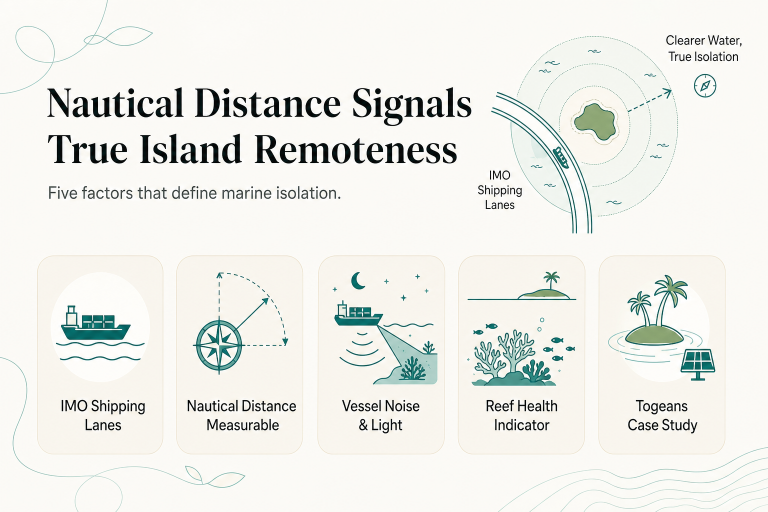
Distance from a shipping lane is one of the most reliable, checkable ways to judge whether an island is actually remote or just marketed that way. A shipping lane is a designated maritime corridor, officially charted by the International Maritime Organization (IMO) through Ships' Routeing measures such as Traffic Separation Schemes under SOLAS Chapter V, that concentrates commercial vessel traffic into predictable routes. An island sitting far outside those corridors sees little to no commercial ship traffic, which means quieter waters, darker night skies, and reef systems that have not absorbed decades of ballast discharge, engine noise, or anchor damage from passing freighters.
TL;DR
- Shipping lanes are IMO-designated corridors under SOLAS Chapter V, not informal shipping routes; distance from them is a measurable proxy for remoteness [imo.org].
- Coastal states can regulate traffic near their shores, but any such measures must align with IMO rules, and international waters generally begin 12 nautical miles from a coastline [imo.org] [amnautical.com].
- Cargo vessels cruise at roughly 10 to 24 knots depending on route and speed-reduction zones, so lane distance also predicts how much vessel noise and light pollution reaches an island.
- The Togean Islands in Central Sulawesi sit well outside the major Indonesian archipelagic shipping corridors, which is part of why their reefs and waters remain unusually undisturbed.
- Reconnect, on Buka Buka Island in the Togeans, is a case study in what that isolation makes possible: near 30-meter average dive visibility and a fully off-grid operation.
About the Author: Reconnect has operated a private island eco-resort and SSI dive center on Buka Buka Island in the Togean Islands since Thomas Despin founded it, giving the team direct, on-the-water experience with what genuine remoteness does to reef health, water clarity, and guest experience over years of daily boat and dive operations.
What Exactly Is a Shipping Lane, and Why Does Distance From One Matter?
A shipping lane is not just "an area where boats go." It is a formally designated corridor, established through IMO Ships' Routeing measures under SOLAS Chapter V, that channels commercial vessel traffic into predictable, monitored paths [imo.org].
Traffic Separation Schemes are the most common form: parallel one-way lanes, similar to highway lanes, that reduce collision risk in busy or narrow waters. Any coastal state wanting to regulate traffic near its shores has to do so in accordance with IMO regulations, not unilaterally [imo.org].
This matters for remoteness because shipping lanes concentrate almost all commercial maritime activity into a small fraction of the ocean's surface. An island 100 nautical miles from the nearest lane experiences a fundamentally different marine environment than one 5 nautical miles away, even if both look identical on a small-scale map.
How Far Do Shipping Lanes Actually Reach From Shore, and Where Does "International Waters" Begin?
International waters generally begin 12 nautical miles from a coastline, marking the edge of a state's territorial sea, though Exclusive Economic Zones extend jurisdiction over resources out to 200 nautical miles [amnautical.com]. Shipping lanes themselves can run through either zone, depending on where the safest deep-water route lies.
Some regulatory zones layer additional rules on top of this. Along parts of the U.S. East Coast, for example, vessels must reduce speed to 10 knots or less over ground during seasonal periods within specific defined areas, a rule designed to protect marine life rather than to mark distance from shore [fisheries.noaa.gov] [arcgis.com].
The practical takeaway: proximity to a shipping lane is not simply "close to land" or "far from land." It is a specific, chartered distance that can be measured in nautical miles from an island to the nearest designated corridor, independent of how close that island sits to a continental coastline.
How Fast Do Cargo Ships Travel, and What Does That Mean for a Nearby Island?
A cargo ship cruising at 10 knots covers one degree of latitude, roughly 60 nautical miles, in about six hours [mol-service.com]. Most commercial vessels operate somewhere in that range up to the low 20s in knots depending on ship type, route, and any seasonal speed restrictions in force.
That speed matters for two reasons beyond simple travel time.
- Noise and light pollution radius. A vessel doing 15 to 20 knots on a lane 20 nautical miles offshore is still visible on the horizon at night and detectable underwater by marine life sensitive to engine noise.
- Wake and traffic density. Lanes that carry higher volumes of ships, even at moderate individual speeds, compound into near-constant background disturbance for anything nearby, from reef fish behavior to the visible night sky.
An island sitting outside this radius, by contrast, keeps its acoustic and visual environment close to its natural baseline. That is a large part of what travelers mean when they describe a place as "untouched," even if they never articulate the mechanism behind the feeling.
Can an Island Be Close to a Coastline but Still Far From Shipping Traffic?
Yes, and this is the distinction most travel marketing collapses. A resort can be geographically near a mainland, an airport, or a port town while still being nautical miles away from any designated shipping corridor, because lanes follow deep-water routes between major ports, not the shape of the coastline itself.
There is also a formal buffer concept worth knowing. In some maritime law contexts, if an island sits within a defined distance of a sea lane's axis coordinate points, shipping is required to stay proportionally further off that island, a buffer rule intended to protect both navigation safety and the island itself [opil.ouplaw.com] [encdirect.noaa.gov].
That buffer is a legal mechanism, not a guarantee of total isolation, but it illustrates the same underlying point: remoteness from shipping is measurable, chartable, and independent of how "far" a place feels on a map.
What Does This Look Like in Practice? A Togean Islands Case Study
The Togean Islands, part of Central Sulawesi within Indonesia's Coral Triangle, sit well outside the archipelago's busiest interisland and international shipping corridors. That positioning is not an accident of geography travelers stumble into; it is the reason the marine environment there looks the way it does.
Reconnect operates on Buka Buka Island in the Togeans, and the resort's own dive logs put average underwater visibility around 30 meters, a figure consistent with waters that see minimal commercial vessel disturbance. The reef systems immediately around the island (walls, pinnacles, and the house reef itself) function as a live indicator of that isolation: healthy coral cover, active fish populations, and clarity that would be far harder to sustain closer to a major traffic corridor.
The resort's own operating model reflects the same logic of self-reliance that distance demands.
| Feature | Detail |
|---|---|
| Power | 93% solar, generator strictly as backup |
| Water | On-site desalination, sun-powered |
| Connectivity | Starlink throughout, despite full off-grid setup |
| Dive access | On-site SSI-certified dive center, reef sites reached by short boat rides around Buka Buka Island |
| Scale | 20 rooms across 8 accommodation types |
Reaching Buka Buka Island itself involves a private car transfer from Luwuk Airport to Ampana (around 5 hours) followed by a private speedboat crossing (30 to 45 minutes), coordinated end to end by Reconnect. That itinerary is a direct physical expression of nautical distance from major traffic. For sustainable tourism in Indonesia, that kind of distance is not an inconvenience to route around; it is the reason the underlying reef and water quality still exist to visit.
Frequently Asked Questions
Does distance from a shipping lane affect water clarity for snorkeling and diving?
Yes. Lower vessel traffic means less sediment disturbance, less engine pollution, and generally more stable reef ecosystems, all of which contribute to clearer water and healthier coral for snorkeling in Indonesia.
Is a private island automatically far from shipping lanes?
Not necessarily. Some private island resorts sit close to busy coastal shipping corridors. Genuine remoteness has to be checked against actual lane charts, not assumed from the word "private."
How do I know if a private island resort in Indonesia is really remote?
Look at the transfer logistics required to reach it. Multi-leg journeys involving flights, road transfers, and boat crossings, like reaching the Togean Islands, are a practical proxy for nautical distance from major traffic corridors.
Do speed restrictions near shipping lanes apply everywhere?
No. Seasonal speed-reduction zones, such as the 10-knot limits used in parts of U.S. coastal waters, are specific regulatory measures tied to particular regions and are not a universal rule for all shipping lanes [fisheries.noaa.gov] [arcgis.com].
Why does an all-inclusive format suit remote islands specifically?
Remote islands typically lack nearby restaurants, shops, or backup infrastructure, so all-inclusive full-board pricing (covering meals, snorkeling, kayaking, and paddleboarding) removes a logistics burden that proximity to civilization would otherwise handle.
About Reconnect
Reconnect is a private island eco-resort with an on-site SSI-certified dive center on Buka Buka Island in Indonesia's Togean Islands, founded by Thomas Despin. The resort runs fully off-grid on 93% solar power with on-site desalinated water and zero single-use plastics, and offers all-inclusive full-board stays from EUR 60 per night across 20 rooms. Guests dive and snorkel reefs averaging 30 meters visibility, a direct result of the region's distance from major shipping traffic.
Ready to see what genuine remoteness feels like? Get in touch with Reconnect at https://reconnect.id to plan your stay in the Togean Islands.
References
- IMO Council reaffirms commitment to protecting vital shipping lanes (imo.org)
- Shipping Fairways, Lanes, and Zones for US waters | InPort (fisheries.noaa.gov)
- International Waters Explained: Boundaries, Jurisdiction & Maritime Law 2025 - Amnautical (amnautical.com)
- Let's see the Routes and Speed of Cargo Ship (mol-service.com)
- ArcGIS (arcgis.com)
- Sea Lanes - Oxford Public International Law (opil.ouplaw.com)
- Layer: Shipping Lanes and Regulations (ID: 0) (encdirect.noaa.gov)