


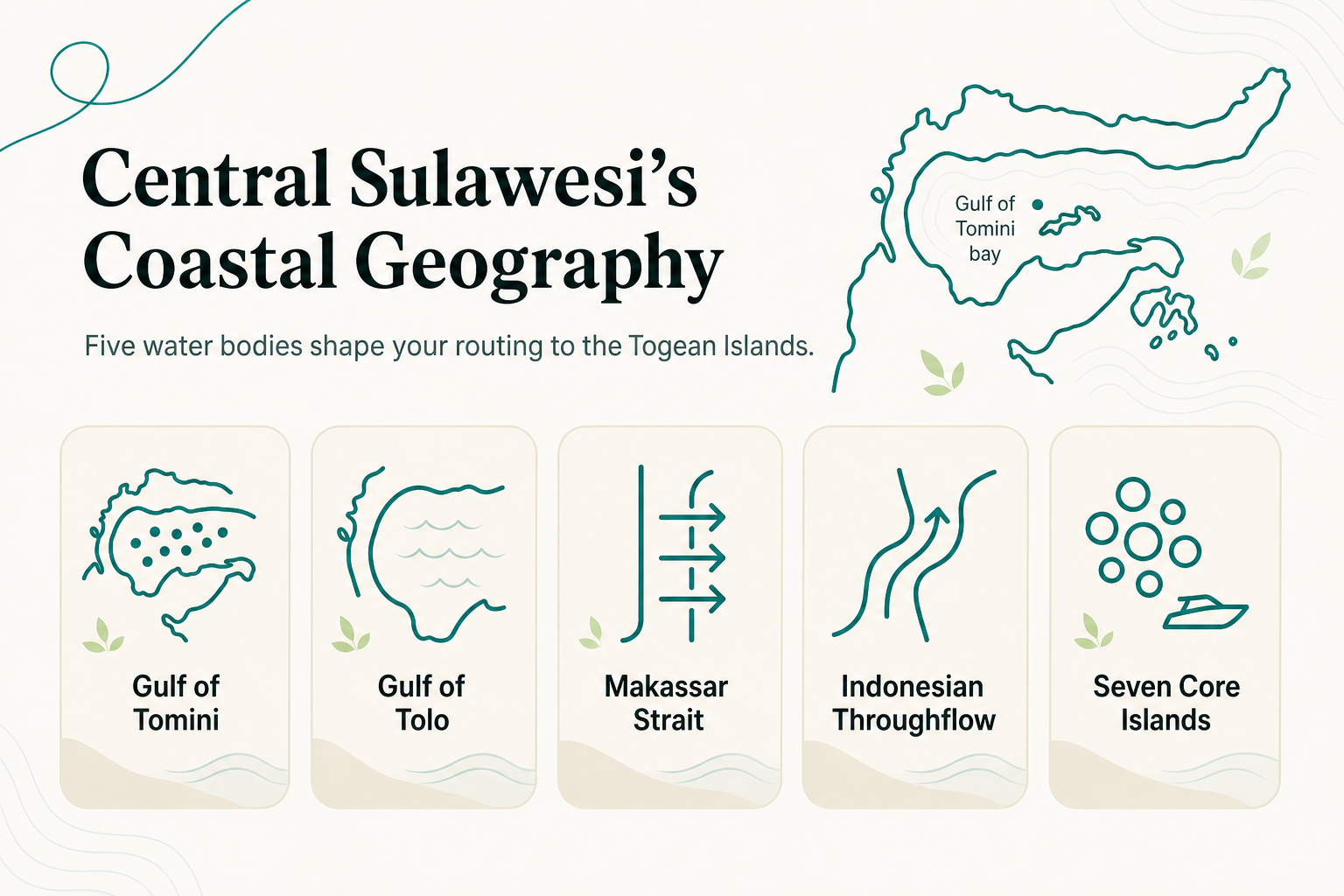
Central Sulawesi's coastline is shaped like a crab's claws wrapped around three major bodies of water, and that geography determines almost every routing decision you will make to reach the Togean Islands. The Gulf of Tomini to the north, the Gulf of Tolo to the east, and the Makassar Strait to the west are not background trivia. They dictate which port you drive to, how long your boat crossing takes, and why some islands sit close together while others are isolated by open water.
TL;DR
- Central Sulawesi's coast is organized around four water bodies: the Gulf of Tomini, Gulf of Tolo, Palu Bay, and the Makassar Strait.
- The Togean Islands sit inside the Gulf of Tomini, in the Tojo Una-Una Regency, centered near 0.39 degrees south latitude and 121.96 degrees east longitude.
- Seven named islands form the core archipelago: Batudaka, Togean, Talatako, Walea Bahi, Walea Kodi, Malenge, and the volcanic outlier Una-Una.
- The Indonesian Throughflow moves through the Makassar Strait and drives seasonal current strength across the region, stronger in the East Monsoon.
- UNESCO designated the area the Togean Tojo Una-Una Biosphere Reserve in 2019, layered on top of the existing Togean Islands National Park.
What Water Bodies Define Central Sulawesi's Coast?
Central Sulawesi's shape comes from four connected water systems, and each one does a different job for a traveler. The Gulf of Tomini forms the long northern bay that the Togean Islands sit inside. The Gulf of Tolo lies to the east, Palu Bay cuts into the island's northwest neck, and the Makassar Strait runs down the western side.
These aren't interchangeable bodies of water. They have distinct current behavior, depth profiles, and port infrastructure, which is why a route that looks short on a flat map can take far longer in practice.
| Water body | Location relative to Togeans | Relevance to trip planning |
|---|---|---|
| Gulf of Tomini | Contains the Togean archipelago | Determines boat crossing routes and sea conditions |
| Gulf of Tolo | East coast of Central Sulawesi | Separate from Togean routing, relevant to Luwuk-area travel |
| Palu Bay | Northwest, near Palu city | Connects to Palu Airport, a secondary access point |
| Makassar Strait | Western coast | Carries the Indonesian Throughflow, affecting regional currents |
The Gulf of Tomini is the one that matters most for Togean trip planning. It is a large, semi-enclosed bay, and that enclosure is exactly why the water inside it behaves differently from the open strait to the west.
Where Exactly Are the Togean Islands Located?
The Togean Islands sit inside the Gulf of Tomini, administratively part of the Tojo Una-Una Regency in Central Sulawesi. Think of it as a lake the size of a small sea: still mostly protected, but big enough that wind direction still matters.
Any Central Sulawesi map worth using for trip planning needs to show the Gulf of Tomini as a distinct feature, not just blank ocean. The gulf's shape funnels boat traffic through a handful of practical departure points on the mainland coast.
What Islands Make Up the Togean Archipelago?
The Togean archipelago is built from seven named islands, not one. Batudaka, Togean, Talatako, Walea Bahi, Walea Kodi, and Malenge form the main cluster, with the volcanic island of Una-Una sitting apart from the rest.
Most of these islands are clustered close enough together that boat hops between them run short. Smaller islets complicate the picture, though. Taipi, for example, sits roughly 2 to 4 kilometers from Kadidiri and Wakai, a distance that is trivial by road and short even by open boat.
This clustering matters directly for choosing Togean Islands accommodation:
- Islands within the main cluster (Batudaka, Togean, Talatako) sit closer to the Ampana port leg, shortening the final transfer.
- Outlying islands like Una-Una sit further from the mainland crossing point, which extends speedboat time regardless of how good the boat is.
- Buka Buka Island, where Reconnect operates, is reached by a dedicated speedboat of 30-45 minutes after the overland leg from Luwuk Airport to Ampana.
The lesson for trip planning: two resorts both labeled "Togean Islands" can sit an hour or more apart by boat. Always confirm which specific island, not just which archipelago, before booking.
Why Do Currents and Tides Vary So Much Across This Coast?
Current behavior across Central Sulawesi's coast is not uniform, and the reason is a specific ocean mechanism called the Indonesian Throughflow. This is a large-scale transfer of water from the Pacific Ocean to the Indian Ocean that passes through Indonesia's internal straits, including the Makassar Strait on Sulawesi's west coast.
Think of the Throughflow as a wide, slow river running through the gaps between islands rather than around them. Its strength shifts with the seasonal monsoon pattern: currents intensify during the East Monsoon and become weaker and more variable during the West Monsoon.
The Gulf of Tomini, where the Togean Islands sit, is partially shielded from the Throughflow's direct force because it is a semi-enclosed bay rather than a strait. That shelter is a large part of why the gulf's waters stay calmer than the open Makassar Strait, and why visibility around Buka Buka Island averages about 30 meters for most of the year. Reef conditions still shift with the monsoon, so timing a dive trip around season, not just around flight availability, is worth doing.
How Does This Geography Shape the Biodiversity You'll See?
The Togean Islands sit inside the Coral Triangle, the marine region recognized for the highest coral and reef fish diversity on the planet. That positioning is a direct consequence of the coastal geography already described: a gulf with varied depth, volcanic islands, limestone islets, and current patterns that mix nutrients without the full force of open-ocean currents.
The area carries two layers of protection. It was established as the Togean Islands National Park, and in 2019 UNESCO designated the wider region the Togean Tojo Una-Una Biosphere Reserve. Reconnect sits in the Togean Islands and operates as a gateway to the National Park through a paid day-trip excursion, rather than inside the park boundary itself.
For a diver or snorkeler, this geography translates into a practical fact: reef walls, pinnacles, and shallow house reefs sit within short boat rides of each other around Buka Buka Island, because the underlying bay geography keeps everything compact rather than spread across open sea.
Frequently Asked Questions
Is the Togean Islands area inside Indonesia's Coral Triangle?
Yes. The archipelago sits within the Coral Triangle, the marine zone spanning several Southeast Asian countries recognized for exceptionally high reef biodiversity.
What's the difference between the Gulf of Tomini and the Makassar Strait for a traveler?
The Gulf of Tomini is a semi-enclosed bay containing the Togean Islands, generally calmer and more sheltered. The Makassar Strait is an open channel on Sulawesi's west coast carrying the Indonesian Throughflow, with stronger and more variable currents.
Does every Togean island have comparable boat access?
No. Islands within the main cluster (Batudaka, Togean, Talatako) sit closer to mainland ports, while the outlying island of Una-Una requires a longer crossing.
Are the Togean Islands part of a protected marine area?
Yes, in two layers: the Togean Islands National Park and, since 2019, the broader UNESCO-designated Togean Tojo Una-Una Biosphere Reserve.
About Reconnect
Reconnect is an eco-resort with an on-site SSI dive center on Buka Buka Island in the Togean Islands. The resort runs fully off-grid on solar power, with on-site desalinated water and an all-inclusive full-board rate from EUR 60 per night across 20 rooms. Guided dives and house-reef snorkeling give direct access to Coral Triangle reefs without long boat transfers.
Explore stays, rooms, and transfer details at reconnect.id.