


A satellite photo of a remote island in Indonesia can show you a green shape ringed by turquoise water. It cannot show you whether that reef has coral cover or bleached rubble, whether the jetty in the corner works, or whether the "resort" pin is a functioning property or an abandoned build. Satellite imagery is a starting point for researching a remote island, not a substitute for the operational and human details that decide whether your trip actually works.
TL;DR
- Satellite imagery reliably shows shape, size, land cover, and coastal change, but not water clarity below the surface, structural condition, or whether a business is operating [bellingcat.com][bbc.com].
- Resolution and revisit frequency vary by provider. Even sub-meter, daily-revisit imagery is blocked by persistent cloud cover, which is common over equatorial Indonesia [bbc.com].
- Color and texture in an image are proxies, not proof. Green does not confirm healthy reef, and a visible rooftop does not confirm an open resort.
- For remote island trips, cross-check satellite views against operator-published specifics: transfer times, room counts, power source, water source, and current guest reviews.
- The Togean Islands, in the Gulf of Tomini off Central Sulawesi, are a case study in why this matters. The map looks simple. The logistics are not.
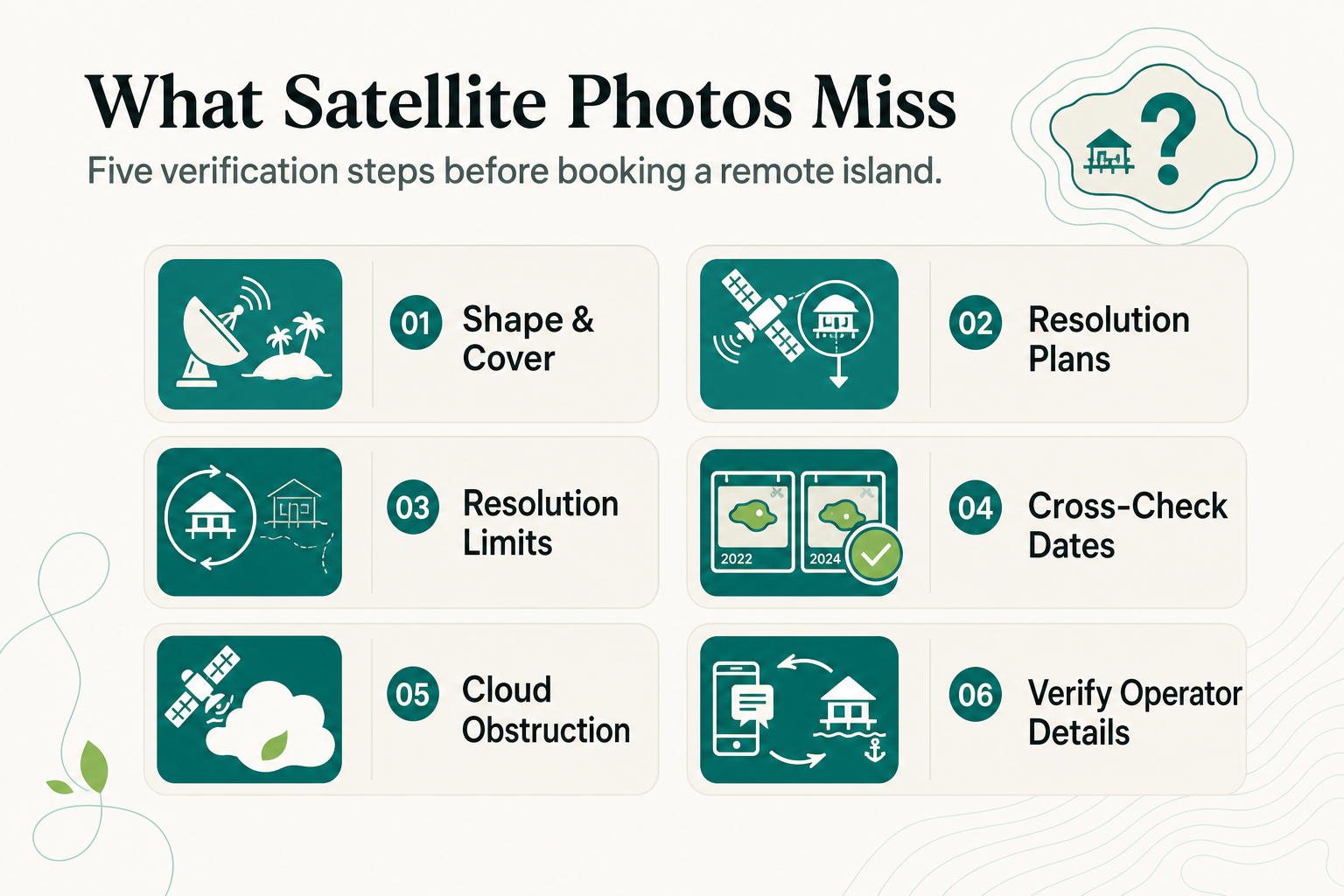
What Can Satellite Imagery Actually Show You?
Satellite imagery captures reflected light across visible and infrared bands, recorded by sensors orbiting at fixed altitudes with fixed revisit schedules [euspaceimaging.com][drivendata.co]. For a remote island, that means you can reliably see coastline shape, vegetation cover, cleared land, and built structures, provided the image is recent and cloud-free.
Multispectral imagery goes further. Near-infrared bands can distinguish healthy vegetation from stressed vegetation, and some services can flag mining activity or deforestation over time [bellingcat.com]. Applied to an island resort search, this is useful for confirming a property has not been recently deforested or that a beach has not eroded significantly year over year.
What it cannot do reliably:
- Show live water clarity or visibility below one or two meters of surface glare
- Confirm a structure is currently occupied, staffed, or open for business
- Distinguish "under construction" from "abandoned" from "recently renovated"
- Detect features under persistent cloud cover, which is frequent over equatorial Indonesia [bbc.com]
That last point matters specifically for the Togean Islands and similar Gulf of Tomini locations, where tropical cloud cover is a near-daily feature, not an occasional one.
Why Does Resolution and Revisit Frequency Matter More Than the Photo Itself?
Two islands can look identical in a free satellite viewer and be completely different in reality, because the image resolution and capture date are doing more work than most travelers realize.
Commercial satellite imagery of remote Indonesian islands ranges from low resolution to sub-meter, with revisit frequencies as often as daily for the highest-tier commercial providers [bbc.com].
A free consumer map may show an image that is months or years old, at a resolution too coarse to show a jetty, a generator shed, or a reef edge.
| Resolution tier | What you can see | What you cannot see |
|---|---|---|
| Low (10m+/pixel) | Island outline, large land clearings | Buildings, boats, reef structure |
| Medium (1-10m/pixel) | Roads, large buildings, forest cover changes | Small huts, jetties, water clarity |
| Sub-meter (commercial high-res) | Individual structures, boats, shoreline detail | Underwater conditions, occupancy status, cloud-obscured areas |
Even at sub-meter resolution, the imagery still cannot see through smoke, haze, or the kind of persistent cloud that sits over the Gulf of Tomini for stretches of the wet season [bbc.com]. A single clear-sky capture, months old, is often the best publicly available image of a small island like Buka Buka. Treat it as a snapshot in time, not a live feed.
How Do You Read a Satellite Photo of a Remote Island Correctly?
Reading a satellite image well means separating what the pixels prove from what they merely suggest, then verifying the suggestion elsewhere.
Step 1: Use color and texture as clues, not conclusions
Analysts interpreting satellite imagery look at tone, texture, pattern, and context together, rather than color alone, because a single band can mislead [science.nasa.gov][eos.com]. Deep blue water near an island can mean a drop-off to open ocean or a shadow from cloud cover. Uniform pale green over water can mean shallow sandy bottom, not necessarily a reef.
Step 2: Compare multiple dates if the platform allows it
A structure or clearing that appears in a 2024 image but not a 2022 image tells you something changed. It does not tell you if the change is a finished building or a stalled one.
Step 3: Cross-reference with a real map and named places
A general satellite viewer will show you the Togean Islands as green dots in the Gulf of Tomini. A proper Togean Islands map, cross-referenced with the operators who actually work there, will show you which islands have year-round accommodation, which are day-trip stops only, and which have no services at all. Administratively, the archipelago sits within the Tojo Una-Una Regency of Central Sulawesi Province, which is worth knowing if you need to cross-check permits or emergency contacts.
Step 4: Verify anything operational directly with the operator
Room counts, meal inclusions, power source, water source, dive site distances: none of this is visible from orbit. It has to come from the operator's own published specifics, ideally with numbers attached.
What Should You Verify Directly With an Operator?
Once you have used satellite imagery to shortlist a general area, the decision-making details for a remote island stay come from the operator, not the photo.
Modern off-grid island resorts run a hybrid setup combining solar arrays, lithium-ion battery storage, and a backup generator. Reconnect's system is 93 percent solar-powered, with the generator strictly as backup, plus on-site desalinated water production so the island has no dependency on shipped-in bottled water or municipal supply.
Before booking a remote island in Indonesia, ask the operator for:
- Exact transfer routing and duration (not "a boat ride," but how many hours, from where)
- Room count and room types, so you know if it is a 20-room property or a 200-room one
- Power source: full-time grid, part-time generator, or solar with battery backup
- Water source: desalinated, trucked, or municipal
- Current visibility and dive conditions if diving or snorkeling is part of the plan
Reconnect's transfer is a private car from Luwuk Airport to Ampana, roughly 5 hours, followed by a private speedboat crossing of 30 to 45 minutes to Buka Buka Island. The house reef and surrounding dive sites around Buka Buka average about 30 meters visibility, reached by short boat rides rather than long transfers, with an SSI-affiliated, Blue Oceans certified dive center on site.
Frequently Asked Questions
Can satellite imagery tell me if an island resort is currently operating?
No. Imagery can show a structure exists, but not whether it is staffed, open, or seasonal. Confirm directly with the operator or through recent, dated guest reviews.
Why does the same island look different across different map apps?
Different platforms license imagery from different providers, captured on different dates and at different resolutions. A free consumer map may be using imagery that is a year or more old.
Does cloud cover really block satellite images of Indonesian islands that often?
Yes. Persistent cloud cover over equatorial regions like the Gulf of Tomini is one of the main limitations even for high-resolution, daily-revisit commercial satellites [bbc.com].
Is a bigger, higher-resolution satellite image always more useful for trip planning?
Not necessarily. Sub-meter resolution helps you see structures and shoreline detail, but it still cannot show occupancy, water clarity, or service quality, so it should complement, not replace, direct operator research.
About Reconnect
Reconnect is a Private Island Resort and SSI dive center on Buka Buka Island in the Togean Islands, Central Sulawesi, founded by Thomas Despin. The property runs all-inclusive full-board stays from EUR 60 per night and is rated 4.9 on TripAdvisor, 4.8 on Google, and 9.2 on Booking.com. To learn transfer times, room details, power and water sources, or current dive site conditions, get in touch through Reconnect.
References
- Beginner's Guide To Satellite Imagery: 10 Terms You Need To Know | European Space Imaging (euspaceimaging.com)
- How to Interpret a Satellite Image: Five Tips and Strategies - NASA Science (science.nasa.gov)
- A Beginner's Guide To Satellite Imagery: 10 Terms You Need To Know (bellingcat.com)
- How To Interpret Satellite Images: Methods, Elements & Uses (eos.com)
- A Beginner's Guide to Satellite Data - DrivenData (drivendata.co)
- Canadian 'island' appears to vanish and reappear miles away, satellite images show (bbc.com)